'Driving the Carretera Austral'

What makes this trip special?

Explore the Carretera Austral

Explore the Carretera Austral

The Aysen region

South from Puerto Montt the Carretera Austral stretches some 1000km all the way down to the small town of Villa O'Higgins. This section of Chile is the most sparsely populated of any in the country and the Aysen region therefore remains one of the most remote and scenic areas to travel to. Exploring by car is a sometimes challenging means of travel, but you will be rewarded with some of the most spectacular scenery Patagonia has to offer.

The Marble Cathedral

The Marble Cathedral

Marble Caves on Lake General Carrera

Geological formations in the centre of Chile's largest lake are accessible only by boat from the town of Puerto Rio Tranquilo. Navigate through the incredible marble caves in small kayaks, and see the different colours and shapes of the limestone rock against the emerald waters upclose.

Itinerary map for Chile 'Driving the Carretera Austral' holiday

Itinerary

  • Day      Overnight
  • 1 Coyahaique
  • 1 R7 turn on C Austral
  • 2 R7 turn on C Austral
  • 2 Puerto Guadal
  • 3 Puerto Guadal
  • 4 Caleta Tortel
  • 5 Cochrane
  • 6 Puerto Guadal
  • 7 Balmaceda
  • 7 R7 turn on C Austral
  • For the detail of each day click the ‘Day-by-day’ tab above.

Day-by-day itinerary for 'Driving the Carretera Austral'

DAY 1

Balmaceda to Coyahaique

You fly from Santiago to Balmaceda in the northern section of Patagonia’s Aysén region, pick up your car and begin your adventure with the short drive north to Coyhaique, the only proper town in the whole region. The 45km journey on paved road takes around 1 hour–an easy introduction to driving in this part of Chile. Check in at your hotel and explore Coyhaique. Around the pentagonal Plaza de Armas there is an artesan market and shops for jewellery, leatherwork, weavings, pottery and wood carvings. The town’s Patagonian Museum includes photo displays on the Carretera Austral’s creation, engineering and construction.

DAY 2
B

Coyhaique to Puerto Guadal

A beautiful 5h drive south on a road that becomes one the most scenic in South America. You drive back towards Balmaceda but turn to enter the Cerro Castillo reserve. Thick forests and 2000m peaks replace the low hills and pampas with which the day began. The road follows a winding course with Cerro Castillo (2675m) in and out of view ahead. Keep your eyes open for the elusive huemul deer. Mountain ranges with hundreds of icy peaks appear in the distance to the south, as you enter beech woods along the wide valley of the Ibanez river and arrive at little Villa Cerro Castillo. After this village the roads are unpaved and conditions more rugged. Weather from the mountains can flip from glorious to shocking and back again in no time. Drive with extra care. Through scenery that grows more and more impressive you turn down a side valley that leads below the Erasmo snowfields high on your right, then beside the Murta river which flows into Lago General Carrera. You follow the lake’s western shore to the hamlet of Puerto Rio Tranquilo, perhaps at a good time for lunch. 5km further at Bahia Mansa boat trips visit the ‘Marble Cathedral’ and ‘Marble Chapels’ formations in a large vein of pure marble that crosses the lake. The ‘cathedral’ is a steep-cliffed promontory jutting over the lake and the ‘chapels’ are niches sculpted into its base by the water. Swirling striations of marble and the play of sunlight off water that is sometimes turquoise, sometimes emerald, conjure special effects. Take a boat trip if the lake is not too choppy from the day’s winds, otherwise return for calmer morning waters. Kayaks are available for experienced paddlers: be wary of rapidly changing conditions. Leave time for your onwards journey–with fine views across Lago General Carrera–to Puerto Guadal, beautifully situated at the south west corner of the lake, where you stay the night.

DAY 3
B

Puerto Guadal

Puerto Guadal is a hub for a huge array of outdoor activity: scenic walks, longer treks, kayaking on the lake, river rafting, horse-riding through forests to a scenic lookout with views across the lake to the Northern Ice Field, and fly fishing for trout, landlocked salmon, and pejerreyes. 5km from town at Maquis Falls a series of cascades tumble through the forest. You could go hiking by yourself, or we can book escorted trips for you in advance. You could instead spend the day driving the ‘Valle de los Exploradores’–a 170km circuit between Lago Tranquilo, La Nutria Falls, Lago Bayo, Exploradores Park and the Exploradores glacier.

DAY 4
B

Puerto Guadal to Caleta Tortel

Today is one of the most scenic drives you may ever experience as you continue 203km to the southern corner of the Aysén region. A viewpoint on the road looks out to where the clear blue waters of the Baker River cascade down a wide cataract to be joined and turned turquoise by the milky Nef river. Driving beside Lake Cochrane and through jumbled foothills along the Baker River you continue through the little settlement of Cochrane with the low Cordon Esmeralda mountains ahead. You pass four lakes in succession, each backed by mountains, in landscapes of untouched wilderness as your little road threads its way through low woods and beside small bubbling rivers. Joining the banks of the Baker River again, now a magnificent swathe of water through the mountains, you suddenly arrive at Caleta Tortel, a fishing village in isolated splendour on Baker Fjord. The fjord, which is ringed by mountains and cypress forests, is fed from the north by the huge Northern Ice Field and from the south by the ginormous Southern Ice Field. Incidentally there is no road on the planet west of you right the way round to Argentina. Overnight in Caleta Tortel.

DAY 5
B

Caleta Tortel to Cochrane

You can choose to spend most of the morning in Caleta Tortel (or add a day to your trip for long boat trips to Glaciers Steffens or Jorge Montt) before turning back north to Cochrane, or you can head back early to explore sights around Cochrane Lake, Tamango Reserve and San Lorenzo Hill. Overnight in Cochrane, a good stop for fuel and groceries.

DAY 6
B

Cochrane to Puerto Guadal

A short 75km drive to Puerto Guadal leaving lots of time for its adventures. You could raft grade II rapids on the Baker River, bike forested trails to a ‘hidden mine’, try the strenuous Meliquina Lake trek or something less demanding, or head for the mountain of fossils past Puerto Guadal with breathtaking views of the San Lorenzo and San Valentín peaks. Overnight in Puerto Guadal.

DAY 7
B

Balmaceda

Driving straight back to Balmaceda airport (241km), you return your hire car and either fly back to Santiago, or to Puerto Montt for the Lake District, or down to Punta Arenas and the Far South.

Guide prices for 'Driving the Carretera Austral'

options based on all year low season mid season high season peak season other season
mid-range hotels 2 people sharing £1,200
Prices are per person and include:
  • all accommodation
  • category G rental car with unlimited mileage for 1 named driver and basic insurance
  • all other travel in Chile
  • meals as indicated (B = breakfast, L = lunch, D = dinner)
Prices do not include:
  • international flights
  • travel insurance
  • airport and departure taxes
  • items of a personal nature such as drinks, tips, laundry, etc
  • any optional excursions you may buy locally

Customer reviews for 'Driving the Carretera Austral'

Recent reviews are shown here from holidays based on this initial design. In each case the itinerary may have been modified (a little or a lot) to suit the individual traveller.

Average

Seasonal information for 'Driving the Carretera Austral'

Along this route in January

Day Location Max °C Monthly rainfall
1 Coyahaique 15°C rainfall 54mm
1 R7 turn on C Austral 16°C rainfall 37mm
2 R7 turn on C Austral 16°C rainfall 37mm
2 Puerto Guadal 16°C rainfall 65mm
3 Puerto Guadal 16°C rainfall 65mm
4 Caleta Tortel 16°C rainfall 146mm
5 Cochrane 17°C rainfall 46mm
6 Puerto Guadal 16°C rainfall 65mm
7 Balmaceda 16°C rainfall 27mm
7 R7 turn on C Austral 16°C rainfall 37mm

Typical weather for January

rainchart

Max °C figures are the average daily maximum temperatures for the month. Rainfall is the average precipitation for the month.

Hotels for 'Driving the Carretera Austral'

Day 1
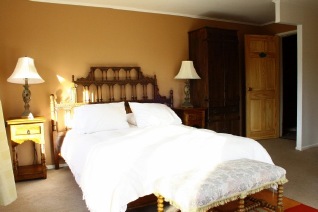
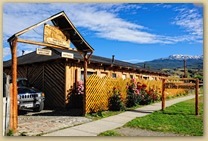
El Reloj

Coyhaique

El Reloj
Double room
Days 2 - 3

Mirador de Guadal

Puerto Guadal

 El Mirador de Guadal is reached by the Carretera Austral and stands on the southern shore of the General Carrera Lake with views over the water and glaciers of the southern ice field. This small hotel has 9 cabin style rooms with a small living area, private terrace and access to the lakeside. Each cabin is named after a regional plant or animal. The larger suites can accommodate up to four people, and are located by the edge of the lake. The hotel’s restaurant serves Chilean and international dishes using many ingredients from the lodge’s garden.
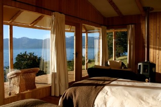
 

Mirador de Guadal
Superior room
Day 5

Entre Hielos

Caleta Tortel

In the remote Caleta Tortel, Entre Hielos Lodge Tortel is tucked into the edge of the forest. Lying between the northern and southern Patagonian ice fields, this boutique lodge offers rooms which are built in Guaitecas Cypress and are surrounded by patagonian jungle. Family-owned and run, this six-room hotel has a personal and homely feel.

Entre Hielos
Day 6

Terra Luna Patagonia

Lake General Carrera

Terra Luna Patagonia